Utility of NDDB GIS Server
The NDDB GIS server is the first attempt of its kind, where village level integration of data has been done, at such a large scale, for the dairy sector. Many GIS analysis, both spatial & non-spatial can be made through this application. Some illustrative examples are given below,
Illustration I:
Kolhapur Milk Union in Maharashtra has initiated a “re-vegetation” activity of a fodder development programme in this village under NDP-I. As a stakeholder, information is required for promoting dairy related activities pertaining to this particular village. The i-DGIS provides the information as below along with map. (Fig: 1)
Village: Gogave,
Tehsil: Sahuwadi
District :Kolhapur (Maharashtra)
Households: 373 Buffaloes : 205 Xbred Cows: 117
Population: 1809 Cultivators: 616 Agricultural Labourers : 14
Village Area (in hectares):764 Cultivated Area: 715 Irrigated Area: 23 Culturable Wasteland: 11
Fig 1: Satellite image of Village Gogave with revenue boundary
It can be seen that along with the village boundaries (which are important to delineate the area within the village, where culturable wastelands are present for possible fodder development) , i-DGIS is able to show the entire datasets pertaining to village wise Human Census, Livestock Census and Village amenities dataset.
Illustration II:
Which are the villages that lie within 2-3 Km on either side of this road? Can some of these villages with dairy potential become part of our program by extending the existing milk route?
Fig 2: Villages located within 2km either side of road
Illustration III:
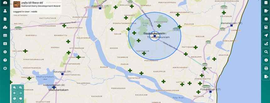
How many villages, say within a radius of 3 km, can we cover if the Bulk Milk Cooler (BMC) is set up in this village? What is the combined breed able bovine livestock population in these villages?
Fig.3: Villages located within 3km radius of BMC.
Illustration IV:
Which villages have been already covered under bulking i.e. Village Based Milk Procurement System (VBMPS)? What is the scope of enhancing the coverage areas?
Fig 4 : Map of villages covered under VBMPS.
Illustration V:
Which is the village where a diary infrastructure, say, Bulk Milk Cooler, is located, when the coordinates are known by GPS readings (XY Longitude/Latitude) but the revenue village name is not known?
Fig. 5: Using GPS coordinates to plot a location on map
Illustration VI:
How to analyze the coverage of retail outlets in a given area?
Illustration VII:
How to map the milk routes using GIS?


