")
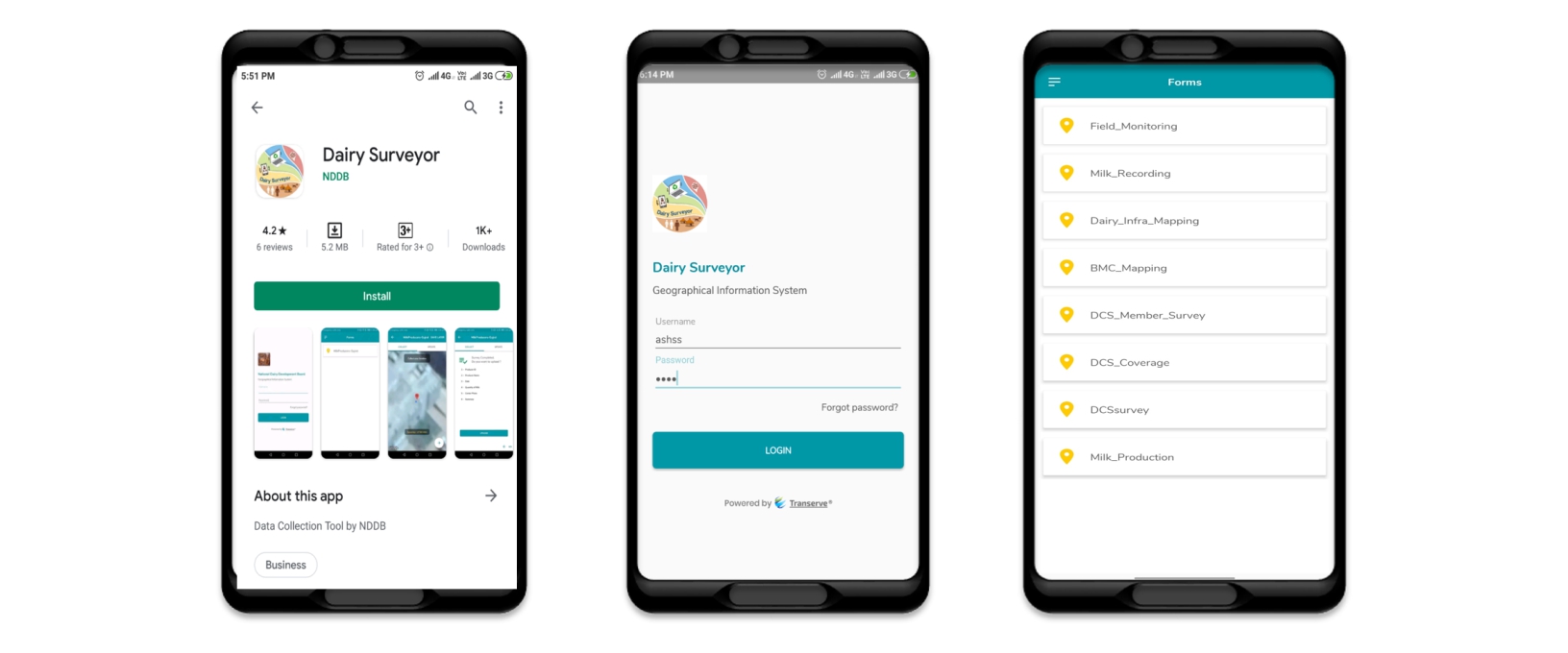
Dairy Surveyor Application
What is Dairy Surveyor Application?
Dairy Surveyor is a GIS-enabled android application developed by NDDB. Dairy Surveyor along with the field data collection, captures latitude and longitude. It provides data analysis in addition to visualisation, which helps the management in making decisions.
What are the utilities of Dairy Surveyor Application?
This application can be utilized for various activities:
• Infrastructure Mapping
• Monitoring the progress of all field activities and surveys
• Procurement activities
• Marketing activities

Figure: Dairy Surveyor utility
What can we do with Dairy Surveyor Application? (Features)
• Enable users to design questionnaire for survey
• Field data collection with Geo-Tagging and Time-stamp
• Real time tracking of field level projects
• Facility to capture and upload photos/signature/audio/video
• Visualization of field data on map
• Analysis of data with locational coordinates
How can Dairy Surveyor application help dairy cooperatives and producer owned institutions?
I. Infrastructure Mapping :
Dairy Surveyor application helps dairy cooperatives to map their supply chain infrastructures (i.e. DCS/MPP, BMC, Chilling Centres, Dairy Plants, Cattle Feed Plants, Milk Booths/Parlours, Retail sales points, etc.)

Figure : Infrastructure Mapping
By mapping of dairy infrastructure, it makes easier for the milk unions in taking transportation decisions related to milk procurement and sales. In addition, it helps milk union in establishment and expansion of new DCS and collection centres along with route optimisation
II. Monitoring Field activities :
Dairy surveyor application can monitor progress of various field related activities such as artificial insemination, vaccination and other input activities

Figure : Monitoring field activity
III. Procurement activities :
• Identifying the DCS, Villages based on locational features
• Setting up the Chilling Centre, AI Centre & BMC
• Route Designing
• Understanding the village coverage
• Mapping of Milk Production and Milk Procurement
• Identification of Potential clusters
• Route-wise Analysis

Figure: Route Designing
IV. Marketing activities :
• Retail Mapping
• Plot/ locate own and competitor milk booths and parlors
• Spatial analysis of consumer data
• Demarcation of different zones
• Analyze markets demographics
• Analyze store product portfolio
• Milk and product distribution routes
• Sales Route Mapping

Figure: Retail mapping
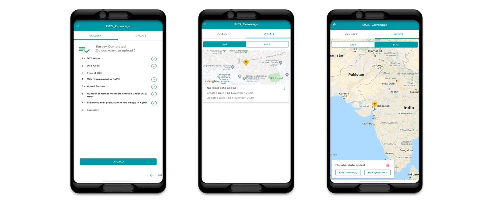
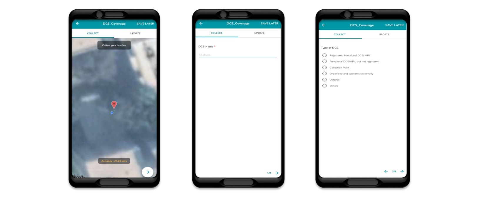
V. Digital Survey :
Traditionally, pen and paper are used for field survey in villages and towns Instead, Dairy Surveyor facilitates digital surveys via smart phones, which saves time and cost. Digital survey also reduces the chances of human errors.

Figure: Questionnaire design
VI. Export of collected data :
With the help of dairy surveyor we can export the collected data to MS Excel. In the backend, the database is created from data collected through dairy surveyors, which can be used for future analysis and planning

Figure: Data collected exported in excel
Click here to know how to access the Dairy Surveyor application